New York City 2034: A Decade of Transformation Towards a Resilient, Connected, and Denser Metropolis
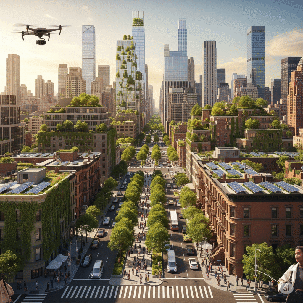
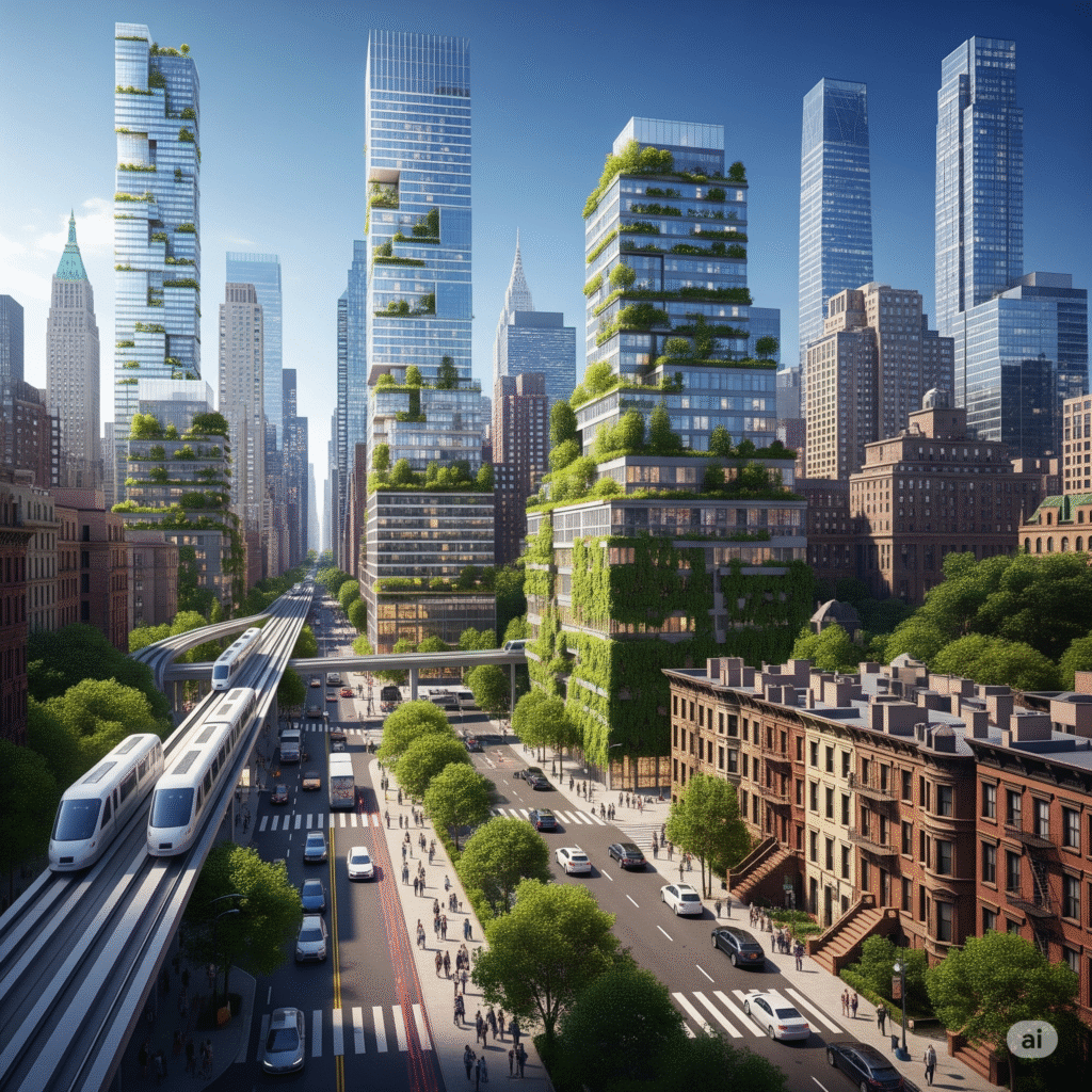
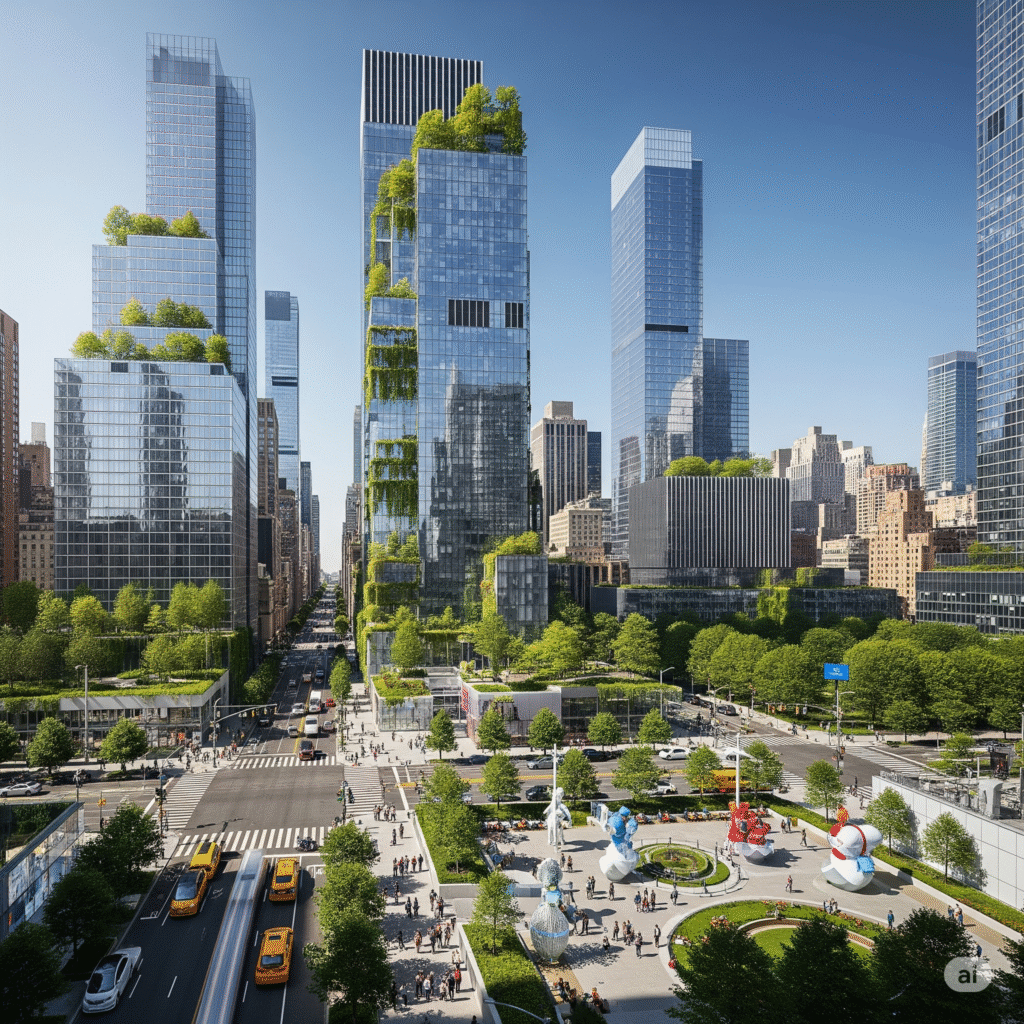
New York City, a global beacon of innovation and resilience, stands on the precipice of a transformative decade. By 2034, the metropolis will have undergone significant physical and functional evolution, driven by ambitious urban planning, substantial infrastructure investment, and a proactive stance against climate change. This report synthesizes current trajectories and planned initiatives, projecting a future New York that is denser, more interconnected, and visibly greener, all while striving to maintain its iconic character amidst an evolving social fabric. The coming ten years will see the city’s skyline and street-level experience redefined by new developments, adaptive reuses, and a pervasive integration of sustainable and smart technologies.I. Executive Summary: A Glimpse into NYC’s Future
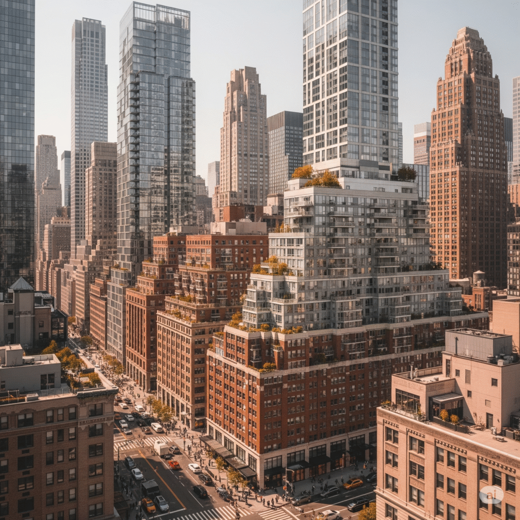
II. Reshaping the Skyline: Housing, Density, and Adaptive Reuse
New York City’s persistent housing crisis and the desire for more equitable growth are driving profound changes in its urban form. Legislative and financial commitments are paving the way for increased density, novel development patterns, and the repurposing of existing structures.The “City of Yes” Impact on Urban Form
Affordable Housing Initiatives: A Visible Commitment
Office-to-Residential Conversions: Revitalizing Commercial Cores
The post-pandemic landscape, characterized by underutilized office spaces, has spurred a significant trend in office-to-residential conversions. NYC’s first wave of these conversions could generate over 17,000 new homes.5 The “City of Yes” amendment actively encourages this by allowing the conversion of most non-residential buildings built before 1991 to housing, with fewer restrictions than before.1 Importantly, there is no residential parking requirement for these conversions, further streamlining the process and reducing development costs.1This shift is expected to be particularly impactful in traditionally commercial neighborhoods like Midtown Manhattan, where many office spaces remain underutilized.2 The widespread conversion of these buildings will visually transform these districts from predominantly daytime office hubs to vibrant, mixed-use, 24/7 residential areas. This will manifest as changes in facade fenestration, with more windows or balconies appearing on former office towers. Ground-floor spaces, once dedicated to business lobbies, may be adapted into residential entrances or new retail establishments, leading to a noticeable increase in evening and weekend street activity. This adaptive reuse not only increases housing supply and returns vacant properties to productive use but also contributes to a more sustainable urban development model by leveraging existing building stock and reducing the carbon footprint associated with new construction.7Neighborhood-Specific Rezonings: Tailored Transformations
Beyond citywide zoning amendments, several neighborhood-specific rezonings are underway, leading to highly localized and distinct visual transformations across the boroughs. These plans reflect unique community visions and challenges, resulting in tailored architectural and public space enhancements.- Gowanus: Approved in November 2021, the Gowanus Neighborhood Plan aims for a thriving, equitable, resilient, and sustainable area with more local jobs and housing, including the critical cleanup of the Gowanus Canal.8 This rezoning is projected to add an estimated 8,500 new apartment units by 2035.10 New renderings for 450 Union Street, a 20-story residential tower, exemplify the architectural style emerging in this area. The building features green-gray concrete masonry, sawtoothed elevations, and setbacks that create outdoor terraces, with ground-floor retail spaces. Its design is specifically oriented to maximize views of the canal, indicating a conscious effort to integrate new development with the unique waterfront environment.10
- SoHo/NoHo: The SoHo/NoHo neighborhood plan, approved in December 2021, seeks to expand housing opportunities, promote equity, and support cultural and economic success.8 It was initially projected to add 1,829 housing units, with 382 to 573 designated as affordable.12 However, the early implementation of this rezoning highlights a potential contradiction between stated goals and actual outcomes. Some initial conversions have resulted in luxury residential units rather than affordable ones, and existing rent-regulated units have been demolished to make way for new developments.12 This tension between policy intent and market-driven realities will be visibly manifest in the architectural character of new developments within these areas, potentially leading to a less inclusive visual transformation than initially envisioned.
- Bay Street Corridor (Staten Island): Approved in June 2019, this plan aims to connect existing mixed-use town centers in St. George, Tompkinsville, and Stapleton, creating a walkable neighborhood with new housing, businesses, and jobs.8 The rezoning from M1-1 and R3X to R6B and R6 allows for medium-density residential uses, leading to a more compact and urbanized built environment.13 The plan also includes “visual corridors,” minimum 60 feet wide, designed with recessed street walls and streetscape-enhancing amenities like lighting or sculptural artwork, and explicitly forbids fencing to maintain openness.14 These design elements will create a more intentional and aesthetically controlled public realm, supported by $250 million in investments.13
- Inwood: The Inwood Neighborhood Plan, approved in August 2018, lays out a vision for creating and preserving affordable housing and fostering vibrant growth through investments in open space, transportation, and infrastructure.8 The plan aims to deliver 925 new affordable apartments on public land, 1,000 on private land, and an additional 675 units through Mandatory Inclusionary Housing (MIH).15 New developments in Inwood are designed to be highly energy-efficient and will offer free broadband internet to residents.16 Visually, this will translate to modern, sustainable residential buildings, and significant improvements to public spaces. Priority intersections along 10th Avenue will see reduced pedestrian crossing distances, new crosswalks, sidewalks, benches, and enhanced street lighting, making the area more pedestrian-friendly and aesthetically pleasing.15
- Jerome Avenue (Bronx): The Jerome Avenue Neighborhood Plan, approved in March 2018, focuses on housing quality and affordability, local economic development, and investments in schools, open spaces, streetscape, and transportation infrastructure.8 This rezoning is projected to add over 3,000 new apartments and 9,500 residents to the corridor.19 It introduces residential zoning to parcels previously designated for commercial or industrial activity and increases density in some existing residential areas.19 A special zoning district has been established to govern building styles near the elevated 4 train, requiring setbacks above the first two stories to ensure adequate light and air to the street, while allowing additional height for better articulated and more attractive buildings.18 Ground-floor retail and active uses will be mandated under the elevated train, creating a more lively and visually interesting streetscape.18
| Category | Metric | Current Status / Projection |
| Housing Supply | “24 in 24” Affordable Housing Projects (2024) | 26 projects advanced, creating/preserving 13,000+ units |
| New Housing Units from “City of Yes” (next 15 years) | 80,000 units enabled | |
| New Homes from Office-to-Residential Conversions | Over 17,000 units potential | |
| One45 Harlem Development | 1,000 units, 338 affordable | |
| Gowanus New Apartment Units (by 2035) | 8,500 units estimated | |
| Inwood Affordable Housing (public land) | 925 units | |
| Inwood Affordable Housing (private land) | 1,000 units | |
| Inwood Affordable Housing (MIH) | 675 units | |
| Jerome Avenue New Apartments (next decade) | Over 3,000 units | |
| Bay Street Corridor New Residential Units | ~1,800 units | |
| Population Growth | NYC Population (July 2024) | 8.48 million |
| Projected NYC Population (by 2035) | 9 million | |
| Projected Bronx Population (by 2035) | 1.57 million | |
| Projected Brooklyn Population (by 2035) | 2.85 million | |
| Projected Manhattan Population (by 2035) | 1.74 million | |
| Projected Queens Population (by 2035) | 2.46 million | |
| Projected Staten Island Population (by 2035) | 500,000 |
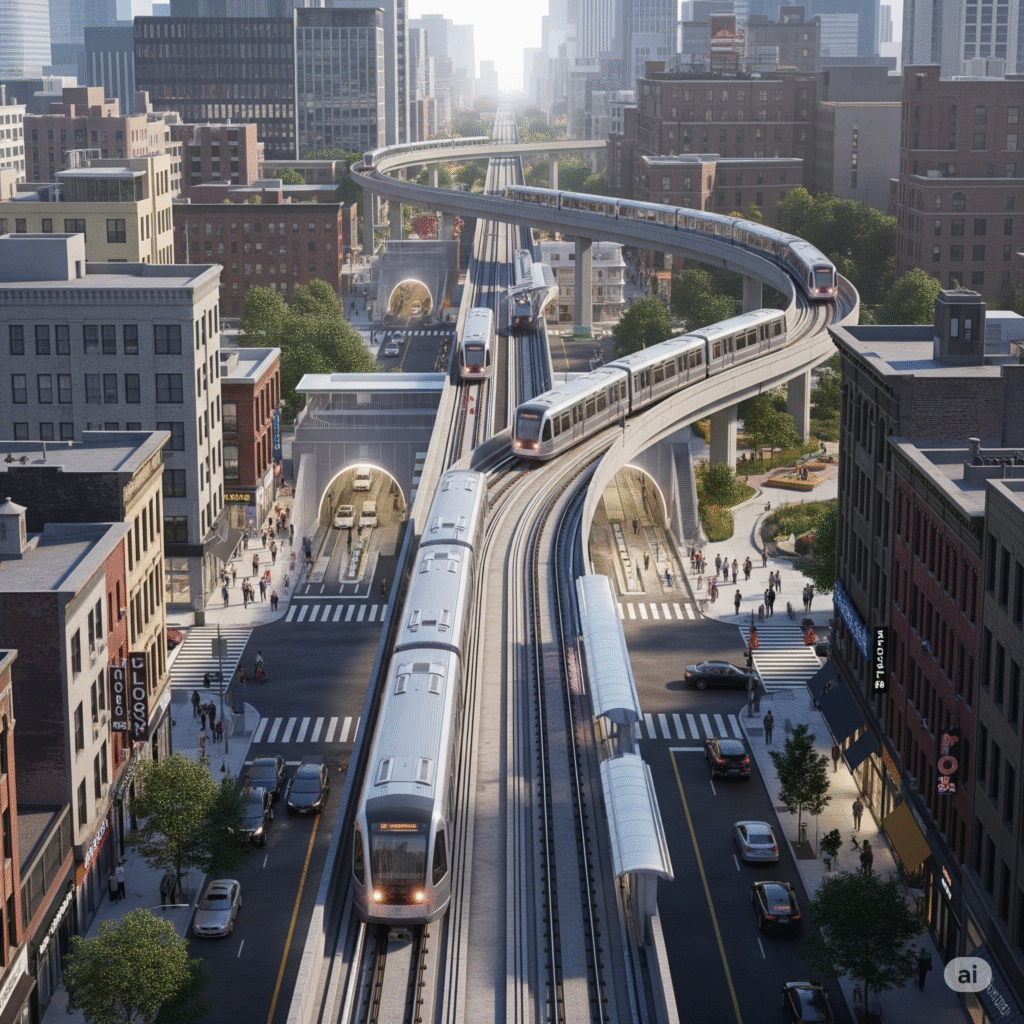
III. Connecting the City: Modernizing Infrastructure and Transit
A hallmark of New York City’s evolution over the next decade will be the modernization and expansion of its vast transportation network. These projects aim to enhance connectivity, improve efficiency, and elevate the user experience across all modes of transit.Interborough Express (IBX): The New Cross-Borough Spine
Penn Station’s Evolution: A New Gateway
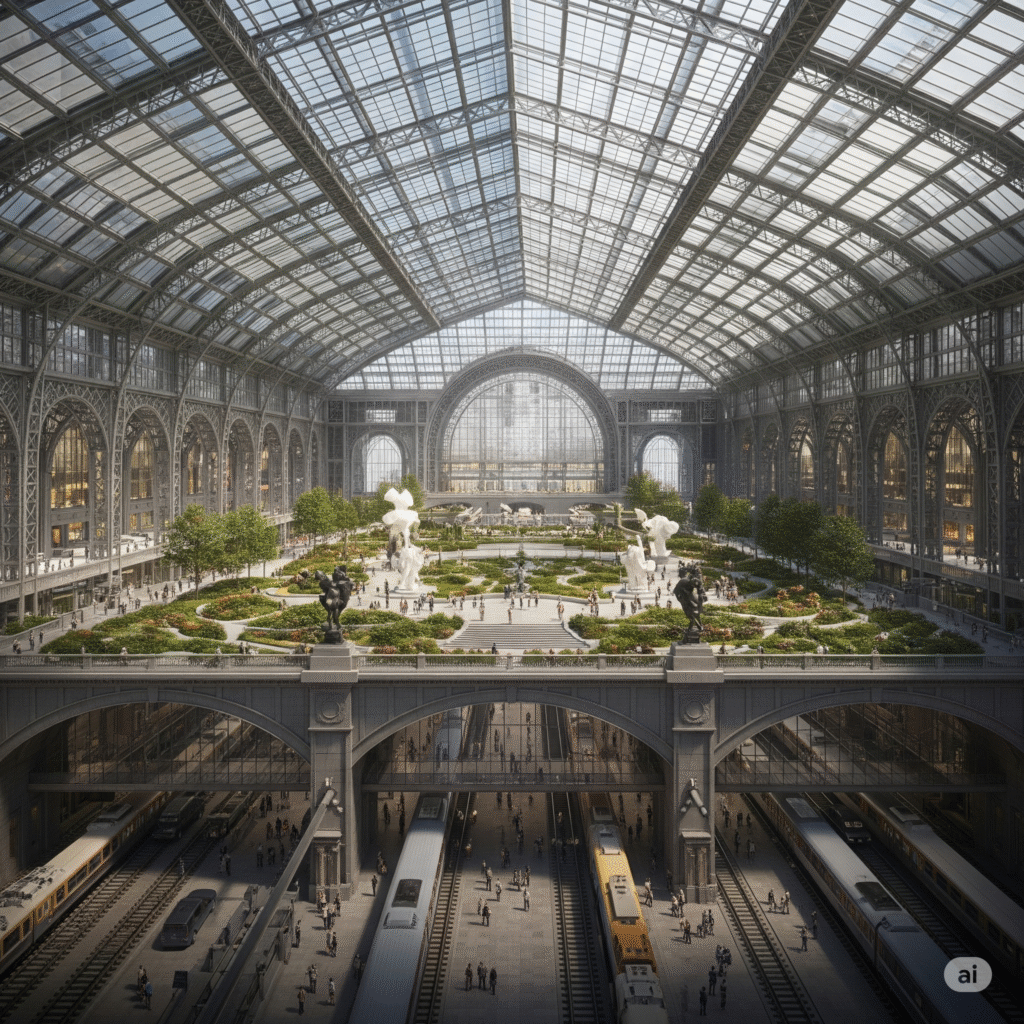
- Vishaan Chakrabarti’s (Halmar-PAU-HOK) design envisions building a rectangular, multilevel station podium around Madison Square Garden (MSG) and recladding the Garden drum with a dense array of fins.32 A prominent feature is a 100-foot-wide central entrance with bronze-framed glass, leading to a spacious sunken train hall. This hall would feature Manhattan’s street grid in relief on its 55-foot-high ceiling, a cascading waterfall representing America’s railroad network, and a subterranean concourse with extensive retail.32
- The Grand Penn Community Alliance, led by Alexandros Washburn, proposes a more radical transformation: relocating MSG to a new site one block east.32 In its place, the plan suggests a steel-and-glass train hall facing a spacious public park, comparable in size to Bryant Park, covering the concourse.32 This vision includes reinstating a classical central portico, aiming to restore the architectural dignity of the original station.32
- ReThink NYC, with architect Richard Cameron’s “McKim Variations,” focuses on reconstructing the original Beaux-Arts Penn Station.32 These proposals include variations that could reclad MSG in a classical facade, add shaded arcades for porous accessibility, triple vertical circulation (stairs, escalators, elevators) to train platforms, and forge more connections to existing subway stations and Moynihan Train Hall.32
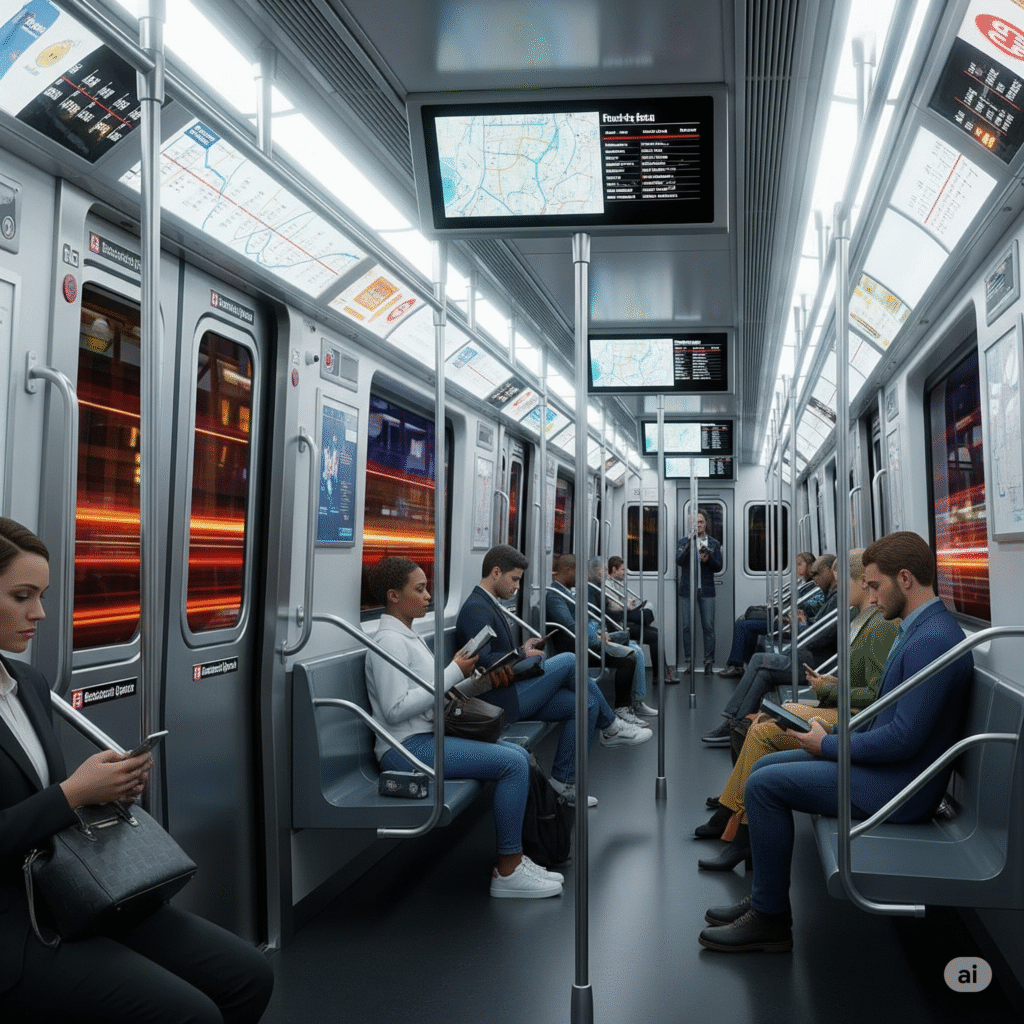
Subway and Bus Fleet Modernization: Cleaner, More Efficient Rides
Smart Transit Enhancements: Streamlined Access
The integration of technology into transit access points will lead to a more streamlined and secure user experience. Modern fare gates are being installed at over 150 stations to prevent fare evasion.22 The first full deployment of these new wide-aisle fare gates occurred at Sutphin Boulevard–Archer Avenue–JFK Airport Station, replacing traditional emergency exit gates that were a major source of fare evasion.46 These wider gates enhance accessibility for passengers with strollers, wheelchairs, and luggage, making entry smoother and more inclusive.46 All new fare gates are equipped with OMNY, the MTA’s tap-and-go fare collection system, further digitizing the transit experience and making entry seamless and largely invisible.46 This subtle but widespread change will enhance the perception of efficiency, accessibility, and security in stations, reflecting a broader trend towards smart city integration and data-driven management.Roads and Bridges: Continuous Upgrades
The city’s commitment to maintaining and enhancing its foundational infrastructure is evident in the significant capital allocated to roads and bridges. The Preliminary Ten-Year Capital Strategy dedicates approximately $29.5 billion to the Department of Transportation, primarily for Bridges and Highways.51 This investment supports the continuous reconstruction and resurfacing of streets and highways, as well as the repair of structurally deficient bridges and tunnels.22Visually, this will translate to smoother roads, visibly repaired bridges (e.g., Shore Road Bridge, Nereid Ave Bridge, Trans-Manhattan Expressway, Miller Highway Bridge), and a generally improved state of good repair across the city’s extensive network.51 The Department of Transportation (DOT) is also developing a predictive model of pavement conditions to more effectively manage and prioritize repaving work.29 This shift from reactive repairs to proactive, data-informed upkeep will lead to less severe deterioration and a more consistent quality of roads across the city, even if the changes are subtle. Furthermore, the Automated Work Zone Speed Enforcement program has been expanded to include MTA Bridges and Tunnels and NYS Bridge Authority properties and extended until 2031, indicating a reliance on technology for safety and efficiency in construction zones, potentially leading to more visible, but less disruptive, work sites.22Table 2: Major Infrastructure Project Milestones (by 2034)| Project Category | Specific Project/Component | Status / Key Visuals by 2034 |
| Rapid Transit | Interborough Express (IBX) | Operational (est. 2027), 19 stations, 14-mile light rail. New tracks & platforms alongside freight lines. |
| Rail Tunnels | Gateway Program: New Hudson River Tunnel | Under construction, new two-tube tunnel for expanded capacity. |
| Gateway Program: North River Tunnels | Rehabilitation of existing 110-year-old tunnels completed or near completion. | |
| Major Transit Hubs | Penn Station Upgrades | Significant progress on modernization. Competing visions: new train halls (Chakrabarti), public park (Washburn), or classical restoration (ReThink). |
| Subway Fleet | New R211 Subway Cars | Thousands deployed. Blue fronts, LED lights, wider doors, accessible, open gangways (R211T), digital displays. |
| Bus Fleet | Zero-Emissions Bus Fleet | Nearly 500 battery-electric buses in service by 2025-26. Quieter, exhaust-free rides. Target: fully electric by 2040. |
| Fare Systems | Modern Fare Gates | Installed at over 150 stations. Wide-aisle gates for accessibility, OMNY-equipped. |
| Roads & Bridges | Capital Investment | $29.5 billion allocated for next decade. Smoother roads, visibly repaired bridges. |
IV. A Greener, More Resilient Metropolis: Climate Adaptation and Sustainability
New York City’s future is inextricably linked to its ability to adapt to climate change and embrace sustainability. The next decade will see a visible transformation of its coastlines and streetscapes, reflecting a comprehensive strategy to fortify the city against environmental threats and integrate green solutions.Coastal Protection and Sea Level Rise: Fortifying the Edges
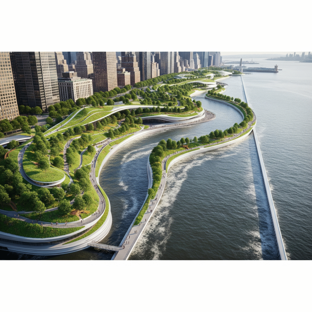
- East Side Coastal Resiliency (ESCR): This integrated flood protection system spans 2.4 miles along the East Side of Manhattan, from Montgomery Street to East 25th Street, with construction continuing through 2026.55 The project includes raised parkland, notably East River Park, which is being elevated by eight feet.55 Floodwalls, floodgates, and interior drainage improvements are being seamlessly integrated into the urban fabric, designed to enhance waterfront access and create new recreational amenities alongside protective barriers.55 Aerial renderings depict the elevated park and floodwalls, showcasing a new, resilient urban landscape.59
- Two Bridges Neighborhood (Lower Manhattan): This area will feature a combination of flood walls and deployable flip-up barriers designed to protect against a 100-year storm surge by the 2050s.56 These innovative barriers are engineered to maintain access and visibility to the waterfront during normal conditions, only deploying when a storm threatens, demonstrating a sophisticated blend of protection and public access.56
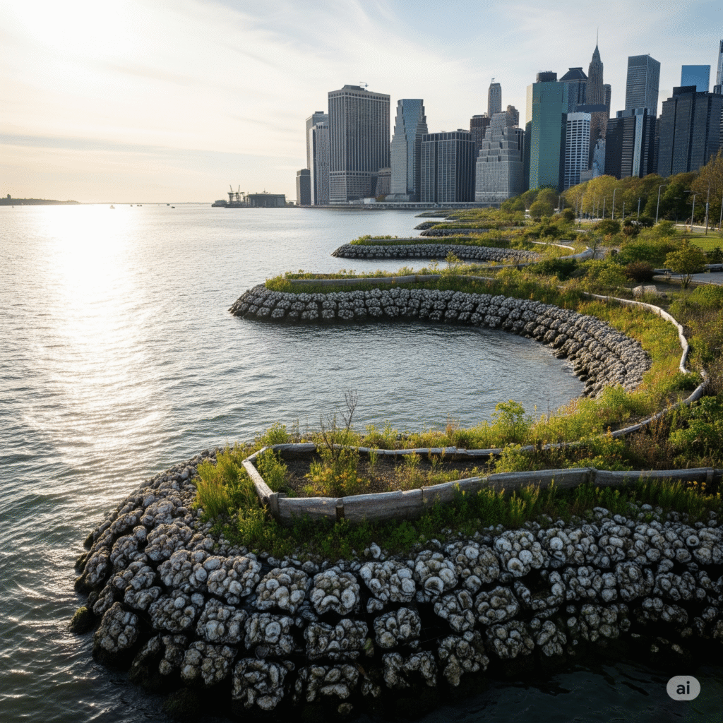
- Tottenville Shoreline Protection Project (Living Breakwaters): Completed in 2024, this Staten Island project exemplifies a growing trend towards nature-based solutions.56 It employs an earthen berm, hybrid dune, eco-revetments, green infrastructure, and restored wetlands to mitigate coastal storm risk.56 Offshore breakwaters, constructed with “reef ridges” and “reef streets,” are designed to dissipate wave energy and provide habitats for marine life, making them “visually accessible” and a tangible example of ecological engineering.62 This project signifies a strategic shift from purely engineered defenses to a hybrid approach that is both functional and ecologically beneficial, visually softening the “hard” infrastructure with “green” elements.
- Jamaica Bay Resiliency: Plans for Jamaica Bay include the development of a Wetlands Interpretive Center and a Science & Resiliency Institute.64 Proposed adaptive design strategies merge ecosystem restoration with layered nature-based features. These include overwash plains, elevated walkways, marsh terraces, and berms designed to improve water quality, support ecological health, and manage flood risk.65 Renderings show proposed overwash plains at Jacob Riis Park with plantings and elevated walkways, and verge enhancements at Howard Beach, illustrating how these interventions will integrate with the landscape to provide protection while enhancing public spaces.66
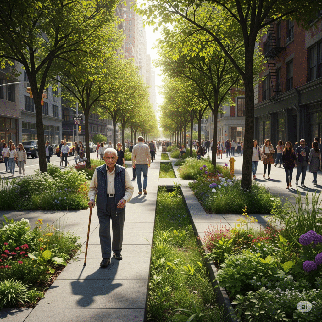
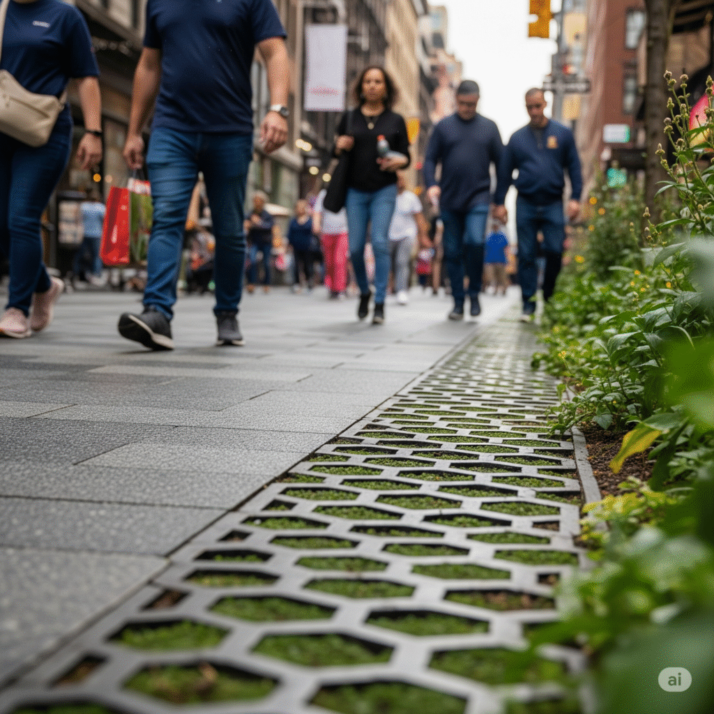
Green Infrastructure Integration: A Greener Streetscape
Renewable Energy Landscape: Decentralized Power
Urban Heat Mitigation: A Cooler, Greener City
| Project Category | Specific Project/Feature | Status / Key Visuals by 2034 |
| Coastal Protection | East Side Coastal Resiliency (ESCR) | Elevated East River Park (8ft), integrated floodwalls & floodgates, new recreational amenities. Construction through 2026. |
| Two Bridges Flood Protection | Deployable flip-up barriers, floodwalls, maintaining waterfront access/visibility. | |
| Tottenville Living Breakwaters | Completed 2024. Offshore breakwaters with “reef ridges” and “reef streets,” earthen berms, hybrid dunes, restored wetlands. | |
| Jamaica Bay Resiliency | Overwash plains, elevated walkways, marsh terraces, berms, Wetlands Interpretive Center, Science & Resiliency Institute. | |
| Green Infrastructure | Rain Gardens & Bioswales (Citywide) | Thousands of installations. Lush, functional landscapes on sidewalks/medians, often with curb cuts and native plants. |
| Greenstreets (Citywide) | 2,500+ installations. Unused road areas transformed into verdant islands with trees, shrubs, plants. | |
| Permeable Pavement (Citywide) | Miles of installations. Subtle change in sidewalk/plaza texture, allowing water drainage. | |
| Green Roofs & Vegetated Walls | Increased prevalence on buildings, transforming barren rooftops into active, productive zones. | |
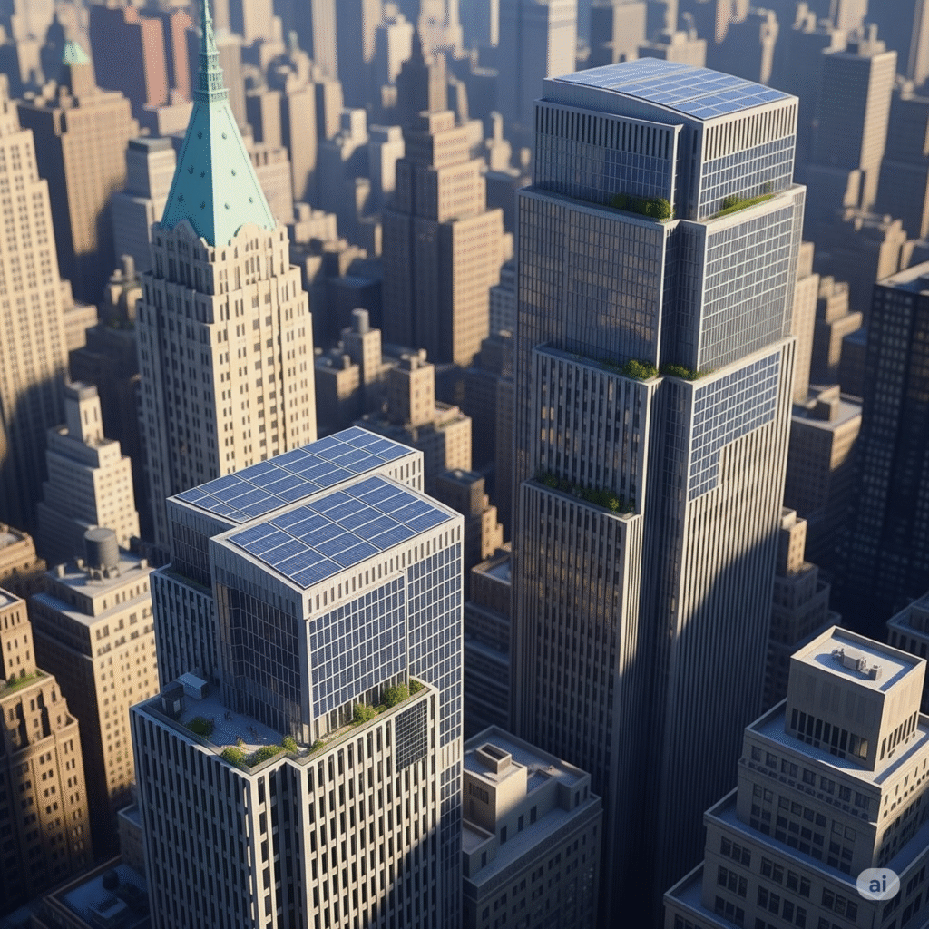
| Renewable Energy | Building-Integrated Photovoltaics (BIPV) | Widespread, subtle integration on rooftops, facades, walkable surfaces. Buildings as energy producers. |
| Offshore Wind Farms (NY Bight) | Barely visible from NYC coastline due to distance, but a strategic energy source. | |
| Urban Heat Mitigation | Shaded/Vegetated Surfaces | Increased tree canopy, architectural shade structures, green roofs, vegetated walls. |
| Light-Colored Pavements/Surfaces | More reflective surfaces on buildings and roads, contributing to cooler ambient temperatures. |
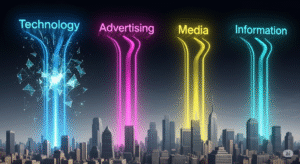
V. The Smart City in Action: Technology and Urban Management
New York City’s evolution into a “smart city” will be characterized by the subtle integration of technology into its urban management, leading to enhanced efficiency and responsiveness, even if many of the technological components remain largely unseen.Sensors and Data: The Invisible Hand of Efficiency
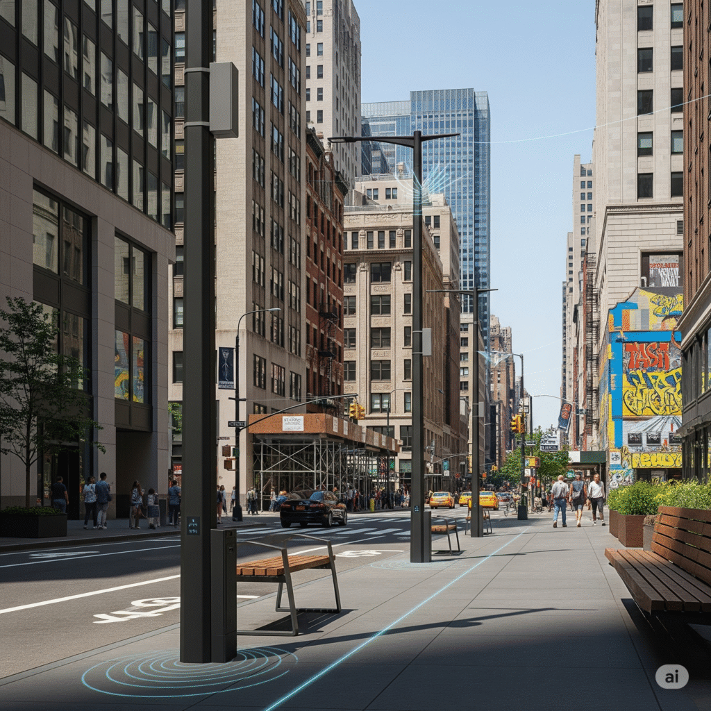
Digital Connectivity: The Ubiquitous Backbone
 Universal broadband access is a foundational strategy within the OneNYC 2050 plan, aimed at closing the digital divide.29 While the physical infrastructure for broadband itself is largely hidden underground or integrated discreetly into existing structures, its widespread implementation will serve as a critical backbone for the functioning of other smart city initiatives. This ubiquitous connectivity will underpin the efficiency of sensor networks, facilitate remote work and learning, and enable a broader range of digital services.The inclusion of free broadband internet for residents in new developments, as seen in the Inwood rezoning, highlights an equity dimension to this digital transformation.16 This means a more connected populace, potentially fewer physical points of access for certain services as they transition online, and a city where digital life is even more deeply integrated into the urban fabric, even if the infrastructure enabling it remains largely invisible.
Cybersecurity Infrastructure: Protecting the Digital Realm
In an increasingly digitized urban environment, robust cybersecurity infrastructure is paramount. The city plans to build the most resilient cybersecurity ecosystem globally, fostering homegrown talent and innovative companies to safeguard city services and institutions.29 This includes the establishment of world-class physical spaces, such as the Global Cyber Center by SOSA and Hub.NYC by Jerusalem Venture Partners, designed for cybersecurity programming and start-up acceleration.29These advancements in cybersecurity will remain largely invisible to the public, as their primary purpose is to prevent disruptions and maintain the integrity of digital systems rather than to create visible features. However, their visual manifestation might be seen in the absence of major system failures or the presence of these dedicated physical centers that serve as visible hubs for this critical, growing industry.29 This highlights a growing reliance on unseen digital infrastructure and the emergence of specialized urban clusters to support it, demonstrating how an invisible but vital function of the city still creates a tangible footprint in the urban landscape.VI. Social Fabric and Architectural Identity: Evolving Urban Life
New York City’s dynamic social fabric is in constant flux, influenced by demographic shifts and the ongoing processes of development and gentrification. These changes are profoundly shaping the city’s architectural identity and the character of its neighborhoods.Population Dynamics: A Growing and Shifting Metropolis
 New York City’s population, estimated at 8.48 million in July 2024, is projected to reach 9 million by 2035 and continue growing through 2055.20 This growth is anticipated across all five boroughs: the Bronx, Brooklyn, Manhattan, Queens, and Staten Island.21 The population has already rebounded after a temporary decline during the pandemic, a recovery accompanied by continued housing production.21This sustained population growth will inevitably lead to a visibly denser city, particularly in areas targeted for housing development. Concurrently, the city’s demographic profile is evolving. While high-income households initially left during the pandemic, the share of low-income households also decreased, and the city has become more diverse, with the proportion of non-White populations increasing.97 The city’s population is also becoming older, with fewer births and more families leaving, though net international migration has rebounded, approaching pre-pandemic levels.97This demographic shift, including an aging population and changing racial/ethnic compositions, will influence the demand for diverse types of housing, public services, and cultural amenities. Visually, this could lead to more multi-generational housing solutions, a greater diversity in retail and cultural establishments reflecting the city’s international migrant inflow, and a more visibly diverse representation of community life across boroughs. The rebound in international migration suggests a continued vibrant, multicultural street life, ensuring that the city’s dynamism remains rooted in its human tapestry.
Gentrification and Preservation: A Contested Visual Landscape
The ongoing process of gentrification will continue to visibly reshape New York City’s neighborhoods, often creating a tension between historical preservation and new development. Gentrification involves the influx of more affluent residents, leading to increased property values and the displacement of lower-income communities, with physical upgrades and new businesses catering to wealthier populations.98In SoHo, for instance, the transformation from an industrial area to a luxury neighborhood saw artists initially occupying lofts, only to be largely priced out as the area became more desirable.99 This process left an “industrial aesthetic” in repurposed homes, where original industrial features are preserved as decorative elements, sometimes obscuring the neighborhood’s working-class past.99 Similarly, in Greenwich Village, the designation of the area as a historic district, while intended to preserve its character, has been argued to perpetuate gentrification by making architectural modifications difficult and inadvertently favoring affluent residents who can afford the high property values.100New architectural styles emerging from this development are often met with public criticism, derided as “Developer Modernism,” “Millennial McMansions,” or “Genericana,” for being perceived as bland, repetitive, and profit-driven.101 This criticism underscores a broader concern that new development is largely informed by budget and building code limitations, rather than unique aesthetic considerations.101 This suggests a future where the visual character of some neighborhoods may become less distinct, driven by cost-effective designs and a focus on maximizing units, potentially obscuring the city’s diverse industrial past.99 The visual landscape will reflect this ongoing debate between preserving unique neighborhood identity and accommodating new growth and investment, with the aesthetic of new development remaining a point of ongoing social and architectural contention.Emerging Architectural Trends: Sustainable and Blended Styles
Future architectural trends in New York City will likely lean towards a “sustainable modernism,” characterized by clean lines, glass facades, and integrated green features. While popular home styles generally borrow from early 1900s forms (e.g., bungalows, Victorians), and industrial styles remain popular, contemporary architecture is increasingly inspired by mid-century modern designs, often featuring flat roofs and exposed beams.102This trend will manifest in more buildings incorporating rooftop gardens, facades designed for energy efficiency (e.g., Building-Integrated Photovoltaics), and materials chosen for their low carbon footprint.37 This creates a distinct visual language for new construction, where sustainability is a key design driver, impacting materials, facade treatments, and rooftop spaces, and fostering a more “performance-driven” aesthetic. There will also be a continued blending of styles, with “Neo-Eclectic” designs incorporating elements from various historical periods, often utilizing architectural stone veneer and external insulation systems to mimic different textures and colors.102 The enduring popularity of the industrial aesthetic, particularly in adaptive reuse projects, ensures that while sustainability is a new driving force, aesthetic diversity will persist, leading to a visually rich, but functionally advanced, new urban fabric.102VII. The NYC of 2034: A Visual Synthesis